Mendocino Headlands State Park to Ingelnook
This whole cabin thing might be gaining traction! We managed to squeeze in another stretch of the coastal walk on June 3 to June 7. This time we stayed in a little cabin in the Caspar Beach RV Park. We had electricity (which equates to air-popped popcorn accessibility…oh, and cell phone charges and stuff) The bathrooms were a little walk down a dirt road and for cooking we were back to propane, but that’s OK, we can’t allow ourselves to get spoiled.
I have never seen so many banana slugs in one area in my life. There were little dime-sized ones and great grandaddy’s. Both the bright yellow ones and the ones with black spots. They were eager to visit us in the cabin, uninvited, and one successfully made it onto the ceiling.
Caspar Headlands State Beach, directly across the road from the RV park, is a beautiful little beach surrounded by hardy coastal grasses. Doyle Creek, which runs through the park, and flows onto the beach in a narrow riverlet makes its way lazily into the sea. The beach is littered with a baffling variety of wash-up seaweed, some of which I’d never seen before including one with broad, tall leaves.
There were layers of the remains of a massive stranding event of by-the-wind sailors like so many ghostly dried leaves in piles along the edge of the beach. I have dozens of things I crave to see in the wild like a tarantula migration and a flamboyance of wild flamings, but a large aggregation of by-the-wind sailors (also known as sea rafts, purple sails, little sails or Velella velellas, their scientific name) in their element would top the list.
On a walk in Southern California, Jo and I had the great fortune of seeing a huge bloom of these surface-water dwelling hydrozoans (they’re related to jellyfish and corals) freshly scattered on the beach. Before that, I’d seen their colorless remains, but this was a garden of indigo creatures still wet from their journey with their tentacles intact. It’s hard not to see the many curving lines on their translucent “sails” as maps or coordinates .
I made my way from one end of Caspar beach to the other and at its northern most point, watched a coyote tromp through a pond of still water. The next evening, I followed the coyote’s path and discovered the ruins of what I later learned was a lumber mill that dated back the mid-1800s. I love it when I peel back the fresh paint of our modern day and find tangible links to another time.
Day one of our walking required more highway shoulder than we prefer, But it got us to Fort Bragg, which felt like a marker for both of us. Earlier in our Northern walks, we had driven to Glass Beach for fun and it seemed so far from our starting place, but here we were, in Fort Bragg at Glass Beach!
Our milage total is currently 590. During our next trip we will cross the 600-mile threshold. We have covered two long stretches of coast so far. The Southern route we’ve walked stretches from the Mexico/Califonria border to Malibu. This stretch is on hold until Malibu sees more recovery from their recent devastating fires.
The Northern stretch runs from Point Lobos in Big Sur to Inglenook. There are some sections of the coast that cannot be safely walked, even for those with a high tolerance for sketchy walking. When we reach such areas, we move our operation inland, sometimes as far as twenty miles, and finish the equivalent distance on the same north/south axis, then come back down to the beach or cliff edges when, “the coast is clear.”
Though I lived in Sonoma County briefly as a young adult and “crashed” on a couch in Humboldt county for several weeks around the same time. I was more focused on looking for work and interacting with friends at that time then on natural beauty so I am really seeing this entire stretch of California for the first time. I am gobsmacked by the beauty and impressed by the many efforts to improve pedestrian accessibly to this breathtaking coastline.
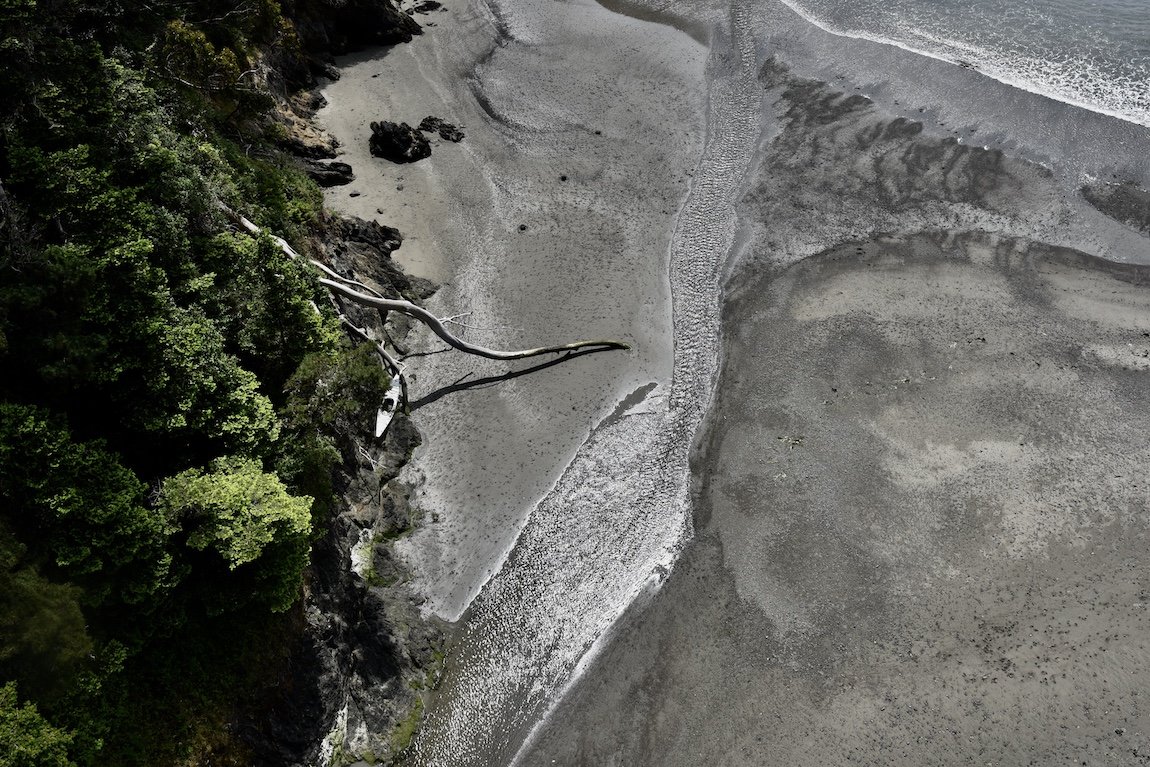
Kayak against the cliff, from high above on a highway overpass
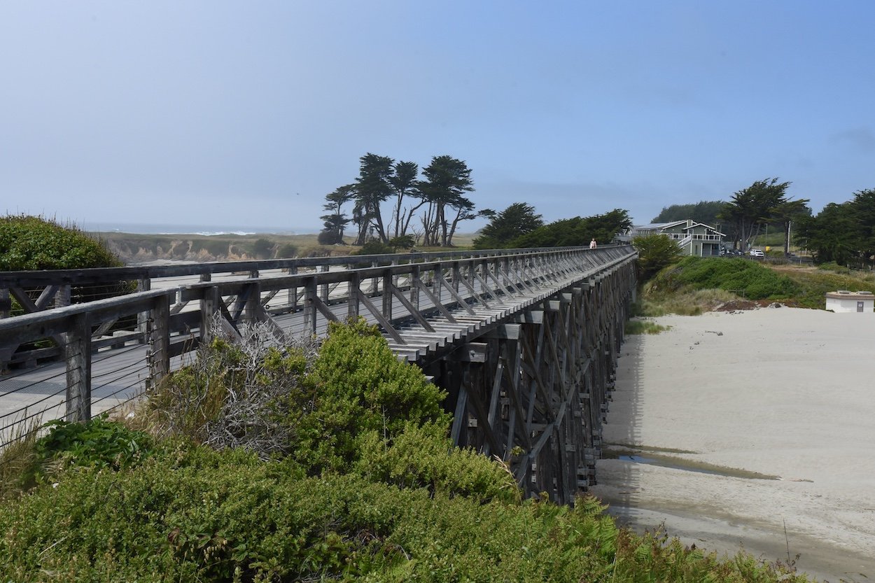
Stunning walking trestle. There’s a collection of padlocks on the far side of the walking path.

Some of the locks on the walking trestle. The salt air adds a distressed look. Many of the locks have simple messages written on them or small notes attached, nods to love and loss.

Our picnic site on day two of this trip. When we arrived, there were half a dozen vultures on the point. The cleared out when and can be seen flying overhead behind Jo. There were a surprising number of wildflowers still in bloom. I didn’t count them, but there were a lot.
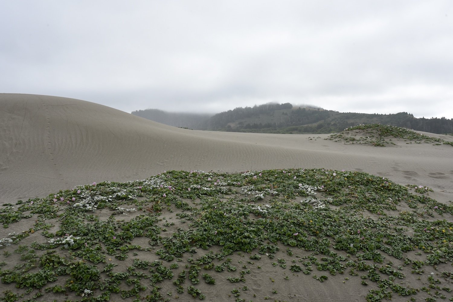
We walked along ten miles of sand dunes. There were a range of animal tracks in the sand. We found two ten-stripe June beetles (one each. Even Steven! We both grew up in large families)

We met the pastor of this church on a previous walk and it was fun to get to see his church, especially the blue door, up close.

This trail was so obscured by plants that it was barely recognizable as a trail. This is when we really appreciate apps like Onxhunt

White digitalis or foxglove, lines the grounds of this organic farm. Jo can be seen booking down the road.

A particularly persistent and surprisingly fast-moving banana slug makes yet another attempt to cross the cabin threshold.